
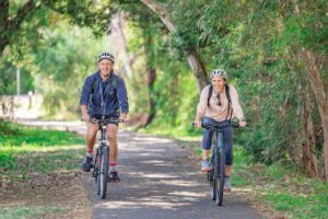
Don’t like the idea of riding on busy roads?
You don’t need to ride the same way you would drive.
Use this map to find traffic-free and low-traffic routes to destinations in your neighbourhood and further afield.
Bike Bendigo received funding through a City of Greater Bendigo community grant and the VicRoads Community Road Safety Grants Program to develop cycling maps for four neighbourhood areas in Bendigo. We hope to continue this work to map cycling routes for the whole municipality.

Let us know what you think!
Send your feedback about the map.

How to use this map
Use suggested cycling routes to choose a route suitable for your level of comfort and riding confidence.
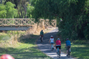
Green = traffic-free shared paths
Orange = quieter roads. Suggested for riders aged 11 years + with a reasonable level of riding skill and an understanding of the road rules.
Red = busier roads. May carry higher traffic volumes and/or faster traffic. Some routes may be busy only at peak times.
Grey = on-road painted lanes (source: DEECA). These include arterial roads with high volumes of fast-moving traffic.
Use quiet residential streets to link suggested cycling routes.
Click or tap on a route or symbol for more info and safety advice.
Use layer menu to turn on/off destination and information symbols.
As a guide: riding 1km takes around 4 minutes (a 3km ride takes around 12 minutes). Unlike driving, It’s usually no slower in peak times.
Disclaimer
Traffic conditions can change at any time and vary according to time of day. Suggestions on this map are of a general nature only and do not represent professional advice.
Users should use their own judgement and seek further advice where appropriate.
Information on this map is correct at the time of release, to the best of Bike Bendigo’s knowledge. Conditions can change at any time, and vary according to the time of day, week and year.
This map does not represent comprehensive coverage of cycling routes within the entire City of Greater Bendigo. Bike Bendigo has focused on four neighbourhood areas and will continue to extend and improve the map as we have capacity to do so.
It is not intended to provide specific guidance for any particular circumstance and should not be relied upon for any decision to take action or not to take action on any matter which it covers. To the maximum extent permitted by law, the author and publisher disclaim all responsibility and liability to any person, arising directly or indirectly from any person taking or not taking action based on the information in this map.

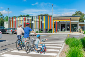


Recommended cycling routes to Bendigo South East College
Bike Bendigo recommends these cycling routes for students and staff riding to BSE. They avoid busy roads where possible and suggest safer places to cross busy roads. Click on a route or symbol for more information.
Yellow and green routes are away from cars.
Orange routes are on-road, including:
– quiet residential streets (pale orange)
– bike lanes on streets with moderate traffic (orange)
– bike lanes on main roads (dark orange).

Recommended cycling routes to Crusoe College
Bike Bendigo recommends these cycling routes for students and staff riding to Crusoe College. They avoid busy roads where possible and suggest safer places to cross busy roads. Click on a route or symbol for more information.
Yellow routes are away from cars.
Orange routes are on-road, including:
– quiet residential streets (pale orange)
– bike lanes on streets with moderate traffic (orange)
– bike lanes on main roads (dark orange).
Back Creek Trail
Fountain to Spring Gully – 7km
Head through Rosalind Park and the Chinese precinct, then along the Bendigo Creek. Go south at the Tennis Centre past the tram museum and under McIvor Road to the popular Back Creek trail and underpass murals. Finish at the cricket oval. Take care at road crossings.
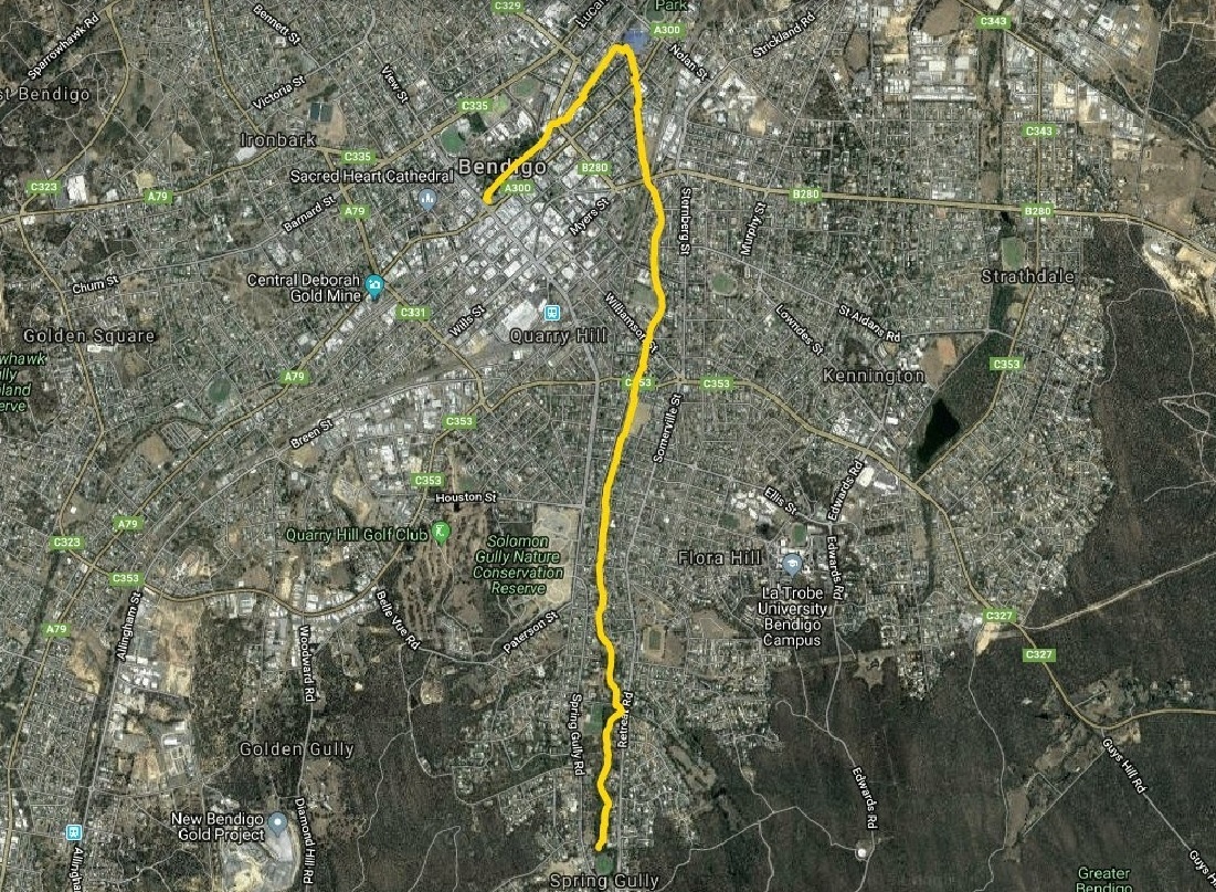
Bendigo Creek Trail South
Golden Square to Crusoe – 8km
From Hargreaves Street, ride south along the Bendigo Creek past Golden Square Pool, Cooinda Park and Gurri Wanyarra Wellbeing Centre and through Kangaroo Flat. Ride alongside Crusoe Road before heading across country to Furness Street and up through the bush to Crusoe Reservoir. Finish with a 3.4km circuit of the lake! Take care at road crossings.

Bendigo Creek Trail North
Fountain to Epsom – 7.5km
Head through Rosalind Park and the Chinese precinct, then along the Bendigo Creek past the Tennis Centre and Lake Weeroona. Take the underpass along the creek under Weeroona Avenue and follow the creek to the Botanical Gardens (4.5km) or continue to Epsom. Minor road crossings.
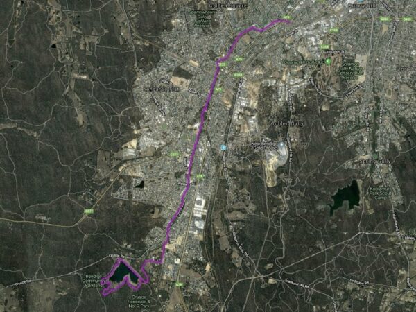
Bike Bendigo Strath Junortoun Community Ride
Strathdale to Strathfieldsaye via Junortoun – 7.5km
Roll downhill from Cousins Street through the bush to a shared path along Trotting Terrace and through McIvor Park Estate. Take quiet streets to the 4.5km shared path downhill through the national park before meandering along Sheepwash Creek to Strathfieldsaye Recreation Reserve. Optional detour to shops. Take care at road crossings.
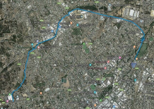
Long Gully Trail
Long Gully to Lake Weeroona – 7km
From Marong Road, the trail takes you behind the Stadium, then turns north-east, passing the Long Gully Reserve and splash park (1.8km). Take care crossing Eaglehawk and Holmes Roads, before skirting Lightning Reef Primary and joining the railway line. Pass Peppergreen Farm across Finn Street, then join the creek trail to ride under Weeroona Avenue and up to the lake.
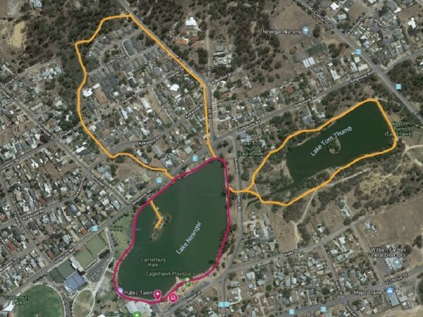
Eaglehawk Loops
Eaglehawk loops – 3.2km
Three short loops form this ride, which starts and finishes at the Eaglehawk Regional Play Space. Start by pedalling 1.2km around Lake Neanger. Add the Mulga Bill Track (an unsealed path with some slight uphill sections, returning to the lake via footpath), and a loop around Lake Tom Thumb. Take care at road crossings.